Dams
Advertisement

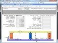
AEC Slope v.1.6
Analyzestability of slopes for roads, railways, river training works, canal embankments, dams on AutoCAD drawing, Swedish Slip Circle,withGraphical Output
Advertisement
GeoMoS v.5.0.0
Leica GeoMoS is a multi-purpose automatic deformation monitoring software that can be used for: - Structural deformation monitoring (e.g. dams, tunnels, bridges, high-rise buildings, construction) - Landslide and settlement detection (e.g.
TechnoLogismiki Works 2011 v.1.0
Introducing TechnoLogismiki Works the most robust solution for Engineers: - Hydraulics: water, sewer and irrigation networks, culverts, dams, solvers. - Hydrology: water budget in catchments and flood flows.

Tamil Nadu v.0.1.0.0
Tamil Nadu app gives a list of some of the most famous tourist destinations in Tamil Nadu. The tourist places are split into different categories such as, Pilgrimages, Heritage sites, Dams, Memorials, Forts etc. Each place is pictorially
Ale - Advanced Land Editor v.4 6
ALE (Advanced Land Editor) is a powerful software to help civil design.
New Mexico Topo Map v.1 50
The purpose of this venture is to create a detailed topographic map of the entire state of New Mexico at 24k detail. This map is created for Garmin GPS receivers and Mapsource.
Florida Topo Map v.1 60
The purpose of this venture is to create a detailed topographic map of the entire state of Florida at 24k detail. This map is created for Garmin GPS receivers and Mapsource.
CCHE2D Beta v.3 28
CCHE2D is an integrated package for two-dimensional simulation and analysis of river flows, non-uniform sediment transport, morphologic processes, coastal processes, pollutant transport and water quality.
EarthPaint v.1. 3. 2001
EarthPaint is an ideal and easy-to-use painting and drawing application for creating graphic overlays for Google Earth.
Terran Atlas v.2.0
Terran Atlas screen shotThe Terran Atlas database now has over 13 million records of city, latitude and longitude information for 250 countries, making it the largest database in the field.
AEC 3D Culverts-Box v.2.0
Program models in 3D of standard or of box type on AutoCAD & computes quantities for planning and managing your roads, canals, dams, and railway banks projects.